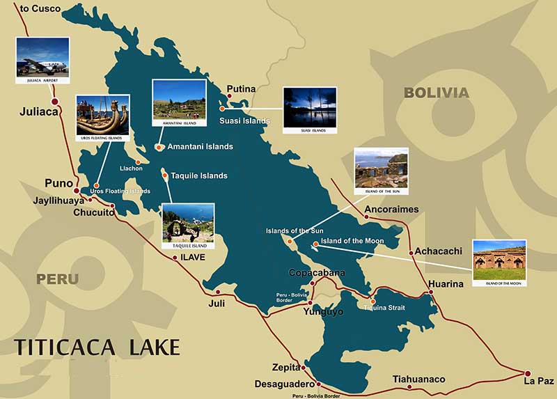
Lake Titicaca is a lake located on the border of Peru and Bolivia. It sits 3,811 m (12,500 ft) above sea level, making it the highest commercially navigable lake in the world. By volume of water, it is also the largest lake in South America (Lake Maracaibo has a larger surface area, but it is often disregarded as it is directly connected to the sea).
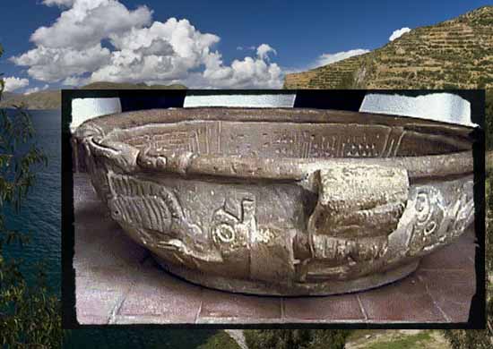
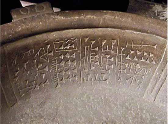
How did an ancient artifact, with Sumerian cuneiform writing, wind up in the Andes? Ancient Alien theorists would argue that it came from aliens who visited here long ago and created our biogenetic experiment. It all goes back to the hidden secrets of Peru and the Inca. Yes there were aliens and locals still report seeing UFOs rise from the water beneath Lake Titicaca.
Fuente Magna, the Rosetta Stone of the Americas Epoch Times - October 2, 2014
The Fuenta Magna is a large stone vessel, resembling a libation bowl, that was found in 1958 near Lake Titicaca in Bolivia. It features beautifully engraved anthropomorphic characters, zoological motifs characteristic of the local culture, and, more surprisingly, two types of scripts - a proto-Sumerian ancient alphabet and a local language of the ancient Pukara, forerunner of the Tiahuanaco civilization. Often referred to as 'the Rosetta Stone of the Americas,' the stone vessel is one of the most controversial artifacts in South America as it raises questions about whether there may have been a connection between the Sumerians and the ancient inhabitants of the Andes, located thousands of miles away.
Ancient temple found under Lake Titicaca BBC - August 23, 2000
Divers went as deep as 30m in their exploration The ruins of an ancient temple have been found by international archaeologists under Lake Titicaca, the world's highest lake. A terrace for crops, a long road and an 800-metre (2,600 feet) long wall was also found under the waters of the lake, sited in the Andes mountains between Bolivia and Peru. Dating back 1,000 to 1,500 years ago, the ruins are pre-Incan. They have been attributed to the indigenous Tiwanaku or Tiahuanaco people, said Lorenzo Epis, the Italian scientist leading the Atahuallpa 2000 scientific expedition. The holy temple measures 200m by 50m (660ft by 160ft) almost twice the size of an average football pitch. More than 200 dives were made into the lake, to depths of as much as 30m (100ft), to record the ruins on film.
Pre-Inca ruins found in lake Titicaca The Guardian - August 23, 2000
The ruins of what is thought to be a huge ancient temple have been discovered by archaeologists diving beneath Lake Titicaca in the Andes between Bolivia and Peru. An international team of scientists announced the finding this week after making more than 200 dives in Titicaca, which, at 3,800m above sea level, is the world's highest navigable lake.
View from Bolivia
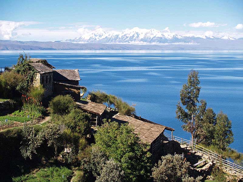
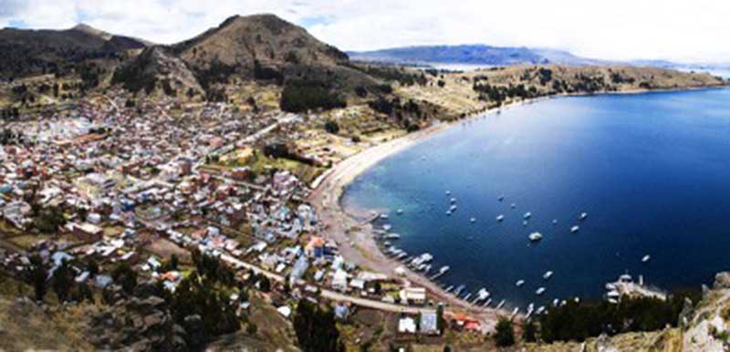
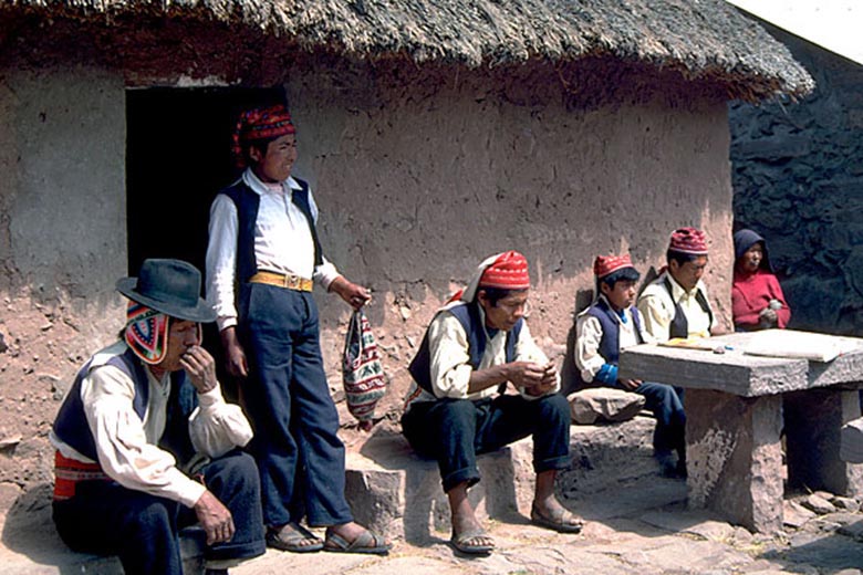
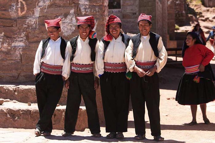
Taquile Island on Lake Titicaca
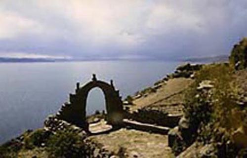
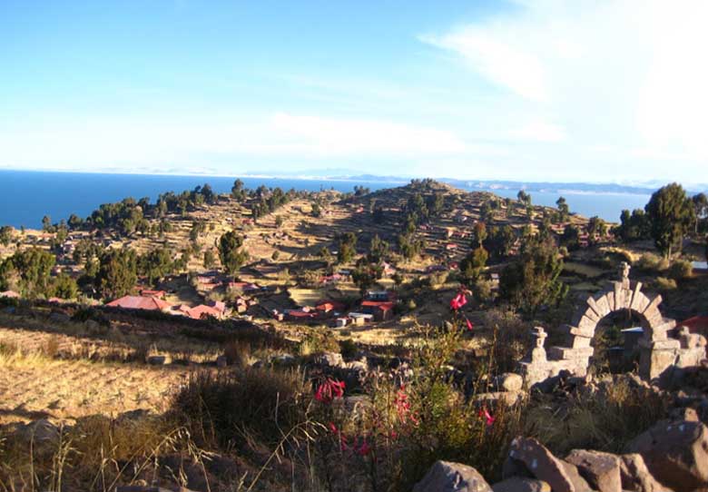

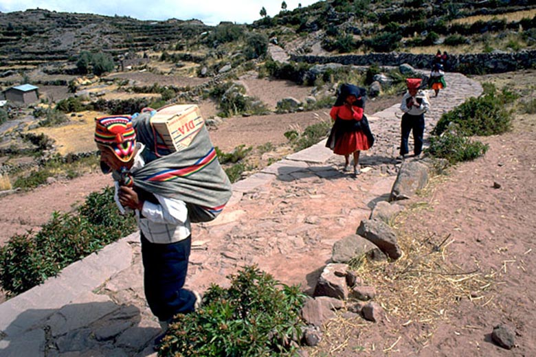
Puno Peru
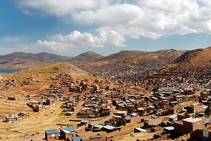

Lake Titicaca is located at the northern end of the endorheic Altiplano basin high in the Andes on the border of Peru and Bolivia. The western part of the lake lies within the Puno Region of Peru, and the eastern side is located in the Bolivian La Paz Department.
The lake is composed of two nearly separate sub-basins that are connected by the Strait of Tiquina which is 800 m (2,620 ft) across at the narrowest point. The larger sub-basin, Lago Grande (also called Lago Chucuito) has a mean depth of 135 m (443 ft) and a maximum depth of 284 m (932 ft). The smaller sub-basin, Winaymarka (also called Lago Pequeno, "little lake") has a mean depth of 9 m (30 ft) and a maximum depth of 40 m (131 ft). The overall average depth of the lake is 107 m (351 ft).
Lake Titicaca is fed by rainfall and meltwater from glaciers on the sierras that abut the Altiplano. Five major river systems feed into Lake Titicaca. In order of their relative flow volumes these are Ramis, Coata, Ilave, Huancane, and Suchez. More than 20 other smaller streams empty into Titicaca, and the lake has 41 islands, some of which are densely populated.
Having only a single season of free circulation, the lake is monomictic, and water passes through Lago Huinaimarca and flows out the single outlet at the Rio Desaguadero, which then flows south through Bolivia to Lake Poopo. This only accounts for about 10% of the lake's water balance. Evapotranspiration, caused by strong winds and intense sunlight at altitude, balances the remaining 90% of the water input. It is nearly a closed lake.
Since 2000 Lake Titicaca has experienced constantly receding water levels. Between April and November 2009 alone the water level has sunk by 81 cm and has now reached the lowest level since 1949. This drop is caused by shortened raining seasons and the melting of glaciers feeding the tributaries of the lake.
Lake Titicaca holds large populations of water birds and was designated as a Ramsar Site on August 26, 1998. Several threatened species such as the huge Titicaca Water Frog and the flightless Titicaca Grebe are largely or entirely restricted to the lake, and the Titicaca Orestias has gone extinct due to competition and predation by various introduced species of trouts and silversides.
The origin of the name Titicaca is unknown. It has been translated as "Rock Puma", allegedly for its resembling the shape of a puma hunting a rabbit, combining words from the local languages Quechua and Aymara, and as well as translated as "Crag of Lead." Locally, the lake goes by several names. Because the southeast quarter of the lake is separate from the main body (connected only by the Strait of Tiquina), the Bolivians call it Lago Huinaymarca and the larger part Lago Chucuito. In Peru, these smaller and larger parts are referred to as Lago Peque–o and Lago Grande, respectively.
The meaning of the name Titicaca is uncertain, but it has been variously translated as Rock of the Puma or Crag of Lead. Titicaca lies between Andean ranges in a vast basin (about 22,400 square miles [58,000 square km] in area) that comprises most of the Altiplano (High Plateau) of the northern Andes. In the snow-covered Cordillera Real on the northeastern (Bolivian) shore of the lake, some of the highest peaks in the Andes rise to heights of more than 21,000 feet (6,400 m).
Titicaca's level fluctuates seasonally and over a cycle of years. During the rainy season (summer, from December to March) the level of the lake rises, normally to recede during the dry winter months. It was formerly believed that Titicaca was slowly drying up, but modern studies have seemed to refute this, indicating a more or less regular cycle of rise and fall.
Titicaca's waters are limpid and only slightly brackish, with salinity ranging from 5.2 to 5.5 parts per 1,000. Surface temperatures average 56¼ F (14¼ C); from a thermocline at 66 feet (20 m) temperatures drop to 52¼ F (11¼ C) at the bottom. Analyses show measurable quantities of sodium chloride, sodium sulfate, calcium sulfate, and magnesium sulfate in the water.
Titicaca (Stone Puma) has lived a long life of millions of years. It contains the sum of all the ages that have molded and defined the works that humans have undertaken in the southern Americas. Over this span of time, that reaches back some two million years, its body of water has been much larger, and encompassed areas today covered in salt flats and wasteland.
Lake Titicaca's fish life consists principally of two species of killifish (Orestias)--a small fish, usually striped or barred with black--and a catfish (Trichomycterus). In 1939, and subsequently, trout were introduced into Titicaca. A large frog (Telmatobius), which may reach a length of nearly a foot, inhabits the shallower regions of the lake.
Ruins on the shore and on the islands attest to the previous existence of one of the oldest civilizations known in the Americas, antedating the Christian era. The chief site is at Tiahuanaco, Bolivia, at the southern end of the lake. On Titicaca Island ruins of a temple mark the spot where, according to the tradition of the Incas (a Quechuan people of Peru who established an empire about 1100), the legendary founders of the Inca dynasty, Manco Capac and Mama Ocllo, were sent down to Earth by the Sun.
In Inca mythology, Manco Capac and Mama 0cllo, children of the Sun, emerged from the depths of Lake Titicaca to found their empire. Like famous naturalist Jacques Cousteau, today's visitors to Titicaca will surely feel the same emotion that captivated the symbolic universe of the ancient Peruvians. With lofty snow-capped peaks along its far shores, the vast blue lake at 3,800m is one of the Andes' most enchanting scenes.
This is an indigenous community of some 350 families which continues to live within the traditions of the 14th century, according to the principles of Inca life. Here, without noting the passing of time, the three golden rules of the Empire of the Sun have been kept: Ama suwa, Ama quella, Ama llulla (do not steal, don't be idle, and do not lie). The contact with other civilizations has not been able to destroy the profound identity of the Inca way.

The Aymara people living in the Titicaca Basin still practice their ancient methods of agriculture on stepped terraces that predate Inca times. They grow barley, quinoa (a type of pigweed that produces a small grain), and the potato, which originated on the Altiplano. The highest cultivated plot in the world was found near Titicaca--a field of barley growing at a height of 15,420 feet (4,700 m) above sea level. At this height the grain never ripens, but the stalks furnish forage for llamas and alpacas, the American relatives of the camel that serve the Indians as beasts of burden and as a source of meat.
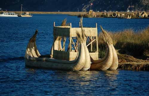
The remnants of an ancient people, the Uru, still live on floating mats of dried totora (a reedlike papyrus that grows in dense brakes in the marshy shallows). From the totora, the Uru and other lake dwellers make their famed balsas--boats fashioned of bundles of dried reeds lashed together that resemble the crescent-shaped papyrus craft pictured on ancient Egyptian monuments.
In 1862 the first steamer to ply the lake was prefabricated in England and carried in pieces on muleback up to the lake. Today vessels make regular crossings from Puno, on the Peruvian shore, to the small Bolivian port of Guaqui. A narrow-gauge railway connects Guaqui with La Paz, capital of Bolivia. The world's second-highest railway runs from Puno down to Arequipa and the Pacific, completing for land-bound Bolivia, an important link with the sea.
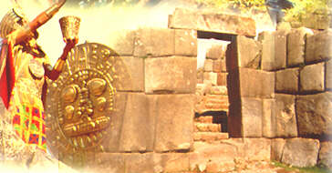
Lake Titicaca and the House of the Golden Sun Disc

By Vera Shapiro
Peru is a land steeped in ancient prophecies and wisdom that is vital for our planet during these transitional times. Life in the Incan empire was measured by a thousand year cosmic cycle called an Inti, which means 'Sun'. This thousand year cycle was then divided into halves, each of which was referred to as a Pachakuti.
The Cosmo vision of the Andean world is the conception of duality that is in permanent opposition, but complementary, like the principle of ying/yang that expresses this opposition between day/night, light/dark, man/woman, earth/sky, up/down. This same principle of duality applies to each Pachakuti. However, Pachakuti also is used to refer to the transitional time that divided each Pachakuti and this is characterized as a time of great changes.
During the five hundred years of the eighth Pachakuti, Pachacuteq, the greatest spiritual leader of the Incas and the builder of Machu Picchu ruled. This was a time of light when the Inca Empire flourished and there was expansion and good fortune.
The ninth Pachakuti, on the opposite side of the duality, brought with it the five hundred years of darkness when the Spanish invaders conquered the Inca and the Andes people lost their power. We are now entering the tenth Pachakuti, which the Andes people refer to as the returning of Pachacuteq, the returning of the Light. This is the time when the etheric crystal cities of the fourth dimension such as the lost golden city of Paititi and the eternal etheric city under lake Titicaca will again be available to us.
There is a legend that says at the time Lemuria was sinking, one of the seven Great Masters of Lemuria, Lord Aramu Muru, was given the mission to bring the sacred Golden Solar Disc from the Temple of Illumination to Lake Titicaca for safe keeping. During the time of the Incas, the Solar Disc was transferred to Cusco, and placed in the Qorikancha, the main Temple of the Sun, where it stayed until the coming of the Spanish. At that time, it was returned to Lake Titicaca and placed in the Eternal Etheric City inside the Lake. In the legend of their origin, this is the place from where the first Incas, M'anko Qapak and Mama Oqllo, entered the Earth.

M'anko Qapak and Mama Oqllo
The Solar Disc was used in the capacity of a cosmic computer that received light information directly from the Universal Mind Source, Wiracocha, at the center of the galaxy. By entering the Temple of Illumination and opening themselves, the Lemurians and later the Incas could access the sacred wisdom. It is during this time, the Age of Pachakuti, that the sacred Solar Disc is to be re-activated accessing the cosmic wisdom.
Many of the world's spiritual leaders, as well as indigenous teachers, acknowledge that the energy of the planet shifted in 1987 from the masculine energies of Tibet to the feminine energies of Peru, and more particular, Lake Titicaca, Machu Picchu, and The Sacred Valley of the Incas. This area is the acknowledged portal through which the new feminine energies are entering Mother Earth 'Pacha Mama".
The Uros of today, still live as the original inhabitants did as they continue to use the totora reeds to build their huts and rafts. The Uros are singular people and even though they keep to themselves very quietly, they do allow people to visit with them.
The Urubamba Valley, also known as the Sacred Valley of the Incas, is one of the most fertile valleys on this planet. Everything that is planted here grows with such abnormal vigor - especially corn and potatoes. The corn here grows approximately three times the size of the corn grown in the U.S. and other parts of the world.